


 En Español
Ecuador Montanita maps
Map and location of Montanita.


Here we present the maps of Montanita Ecuador and its geographical location.
Montañita is part of the province of Santa Elena and part of the so-called Ruta del Sol, formerly Ruta del Sol.
The first geographical map showing the location mound in the province of Santa Elena. As seen in the map, the village is located between the towns of Salinas and Manta, half way between the two. It is undoubtedly the most important people of the Ecuadorian coast.
Montañita is closest to the city of Guayaquil (3hrs drive). 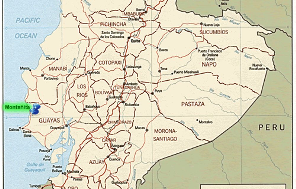
It is located an hour and a half to three hours Salinas and Manta.
Its nearest villages are Olon Manglaralto the north and the south.
It is a resort for the area and I is strategically located, allowing travel the southern coast of Ecuador smoothly and with travel times of no more than 3 hours.
This makes Montanitas is chosen by thousands of tourists every year.

